Part 1 | Part 2 | Part 3
| Part 4
| Part 5
| Part 6
| Part 7
| Part 8
| Part 9
| Part 10
| Part 11
| Part 12
| Part 13
| Part 14
| Part 15
| Part 16
| Part 17
Part 18
| Part 19
| Part 20
| Part 21
| Part 22
| Part 23
| Part 24
| Part 25
| Part 26
| Part 27
| Part 28
| Part 29
| Part 30
| Part 31
| Part 32
| Part 33
| Part 34
| Part 35
| Part 36
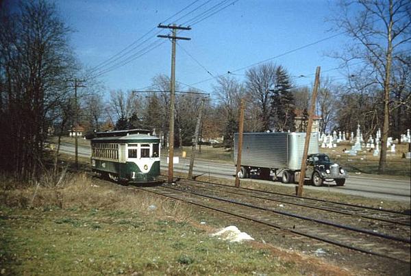
Part 36: Traces of Northern Kentucky streetcar route can still be seen
Historic photo (below) of a Ft. Mitchell line car across from St. Mary's Cemetery, travelling from Covington.
The next photos show the path of the streetcar through Covington, Latonia and Park Hills.
Streetcar path at the Eastern Avenue right-of-way at Durrett Street in Covington near the edge of Wallace Woods.

Cracks in the street, and a wayward drain, reveal buried tracks turning from Caroline Avenue onto Southern Avenue in Latonia.

Location of the Rosedale loop at 45th Street and Huntington Avenue in Rosedale.

The line's route at Amsterdam Road and Hamilton Road in Park Hills.

Below is a section of the line in Park Hills.

The streetcar line eventually meets Dixie Highway and continues to the turnaround loop near Orphanage Road. Then works its way back to Covington.
See more streetcar photos at the actual website by clicking here >
|